
In September 2019, I took a class called “Map Making with Fabrics” which was hosted by the Central Jersey Modern Quilt Guild. The instructor was Timna Tarr. I learned about Timna’s map quilts on Instagram several years ago. I was intrigued by her quilts and wanted to learn the technique. When I read about Timna coming to New Jersey, I made a point of registering for her class.
The students have to bring a paper map to class to use as inspiration. Since I am from Newark, New Jersey, I searched for a map of the city. I found a map of part of the city from 1889. Since the map is that old, it is in the public domain. I had the map printed as a 24” x 36” poster because I intend to place the map in a frame.

When I was in class I noticed that the map’s orientation is actually incorrect. North is not at the top of the map. Here’s the map’s correct orientation and the “My Fair City” Quilt.

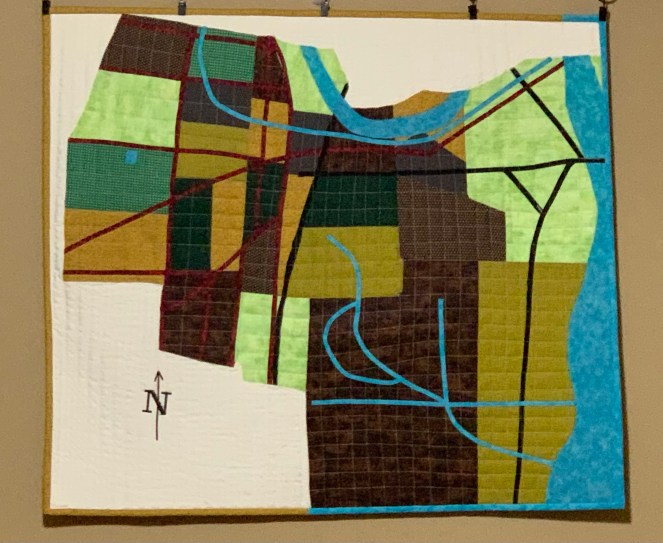
My Fair City Quilt ~ 2019
Because I refer to Newark as “My Fair City”, I used that phrase as my quilt’s name. I used different fabrics to highlight the neighborhoods (the red numbers and boundary lines) that are featured on my paper map. Newark’s nickname is “Brick City.” I used a brick red fabric to represent the major streets and avenues. The black fabric lines are the railroad tracks. The turquoise fabric represents the various waterways. I used a grid design to quilt the neighborhoods to represent the smaller streets. The white fabric represents the area that was not a part of Newark, New Jersey in 1889.
Thank you for reading.

